Recently, Li Zhe, Associate Professor from the School of Architecture at the Tianjin University, joined the scientific investigation for historic heritage sites and ecological research in the Moorea, French Polynesia. It was the first time that Tianjin University has applied its unmanned aerial vehicle (UAV) technology to international scientific investigation.
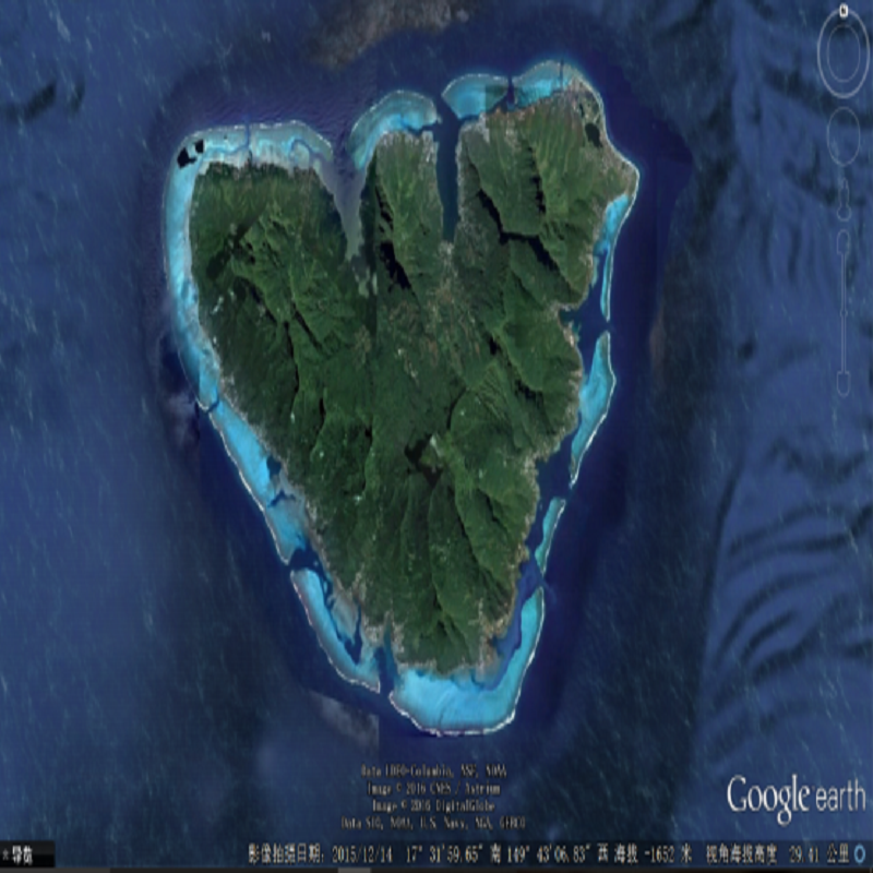
Moorea is one of the high Windward Islands in French Polynesia, part of the Society Islands, 17 Kilometers northwest of Tahiti. With the highest mountain being 1207 Meters, Moorea is about 16 kilometers in width from the west to the east, and the total area is 132 square kilometers (with the perimeter of 60 kilometers).
The Moorea Avatar is sponsored by over 20 world class universities include University of California, University of Oxford, University de Paris VIII, University de Paris 10 Nanterre La Défense, University Paris-Est-Créteil Val de Marne, and ETH Zurich. The Moorea Avatar is a digital representation of the island as it is to today, while other versions draw on the best-available scientific knowledge to show what it looked like in the past and to predict how it might look in the future.
Li Zhe is a visiting scholar at the ETH Zurich. His tenure is from November 2015 till November 2016. He also participated in Moorea Avatar by applying his information collection experience to the research of cultural heritage sites.
Li Zhe worked as a core member in the Moorea Avatar and spent twenty-two days on the island. His research responsibilities involved the low altitude information collection and the research results included the following:
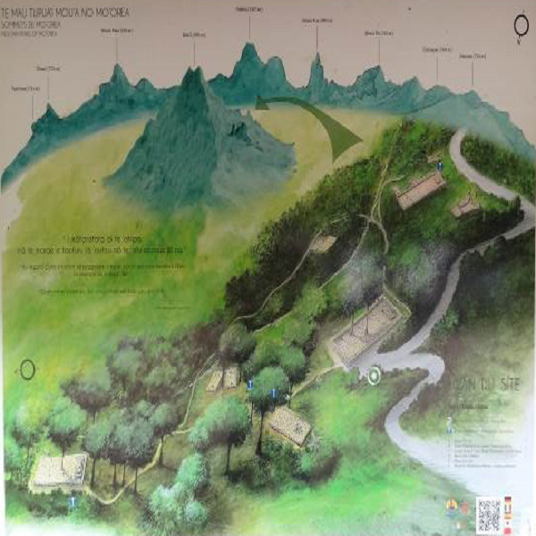
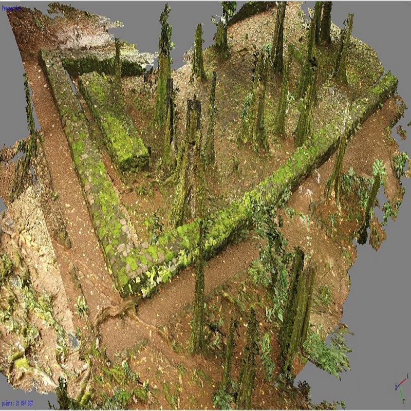
Use the Tianjin University unmanned aerial vehicle to plot and map the ancient Polynesian temples, historic buildings, activity spaces, and other architecture sites in the rain forest.
Li Zhe conquered numerous difficulties, developed a new technique for unmanned aerial vehicles to fly under the crown layer in tropical rain forests. This new flying technique will provide a significant method for the surveying and mapping of the heritage sites in forests, wooded hillsides, and swamps of southern China.


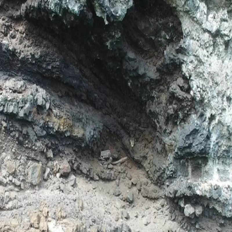
First survey and images of the Polynesian hanging coffins/cliff burials.
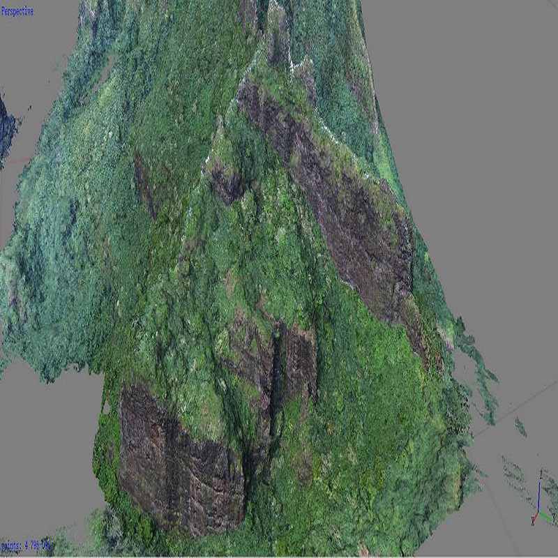
So far, the cliff burials were only found in China, Ryukyu Islands, the Philippines, Melanesia, and Polynesia. Using the unmanned aerial vehicle, Li Zhe carefully searched the Puhino Cliff in Moorea (the total surface area is 180,000 square meters), took imagines from inside the caves, and finally discovered the cliff burial relics from ancient Polynesia times. He also performed the 3D mapping for the Puhino Cliff and its caves. All the data would be used in the heritage declaring, reporting, and protecting process.
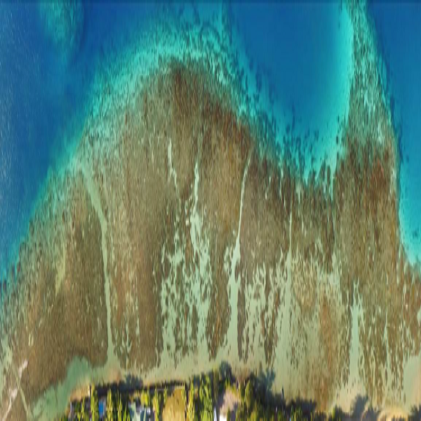
Survey and image of lagoon aquatic organisms in Low altitude (lower than ten meters)
In order to clearly distinguish the distribution and growth of the aquatic organisms such as corals in diving areas, and accelerate the coastal ecological investigation speed, Li Zhe, employed the unmanned aerial vehicle to take imagines of lagoon aquatic organisms from low altitude (lower than ten meters). It is reported that his professional experience and high technological level was highly regarded by the research partners from United States and France.

Li Zhe, Associate Professor of Tianjin University and visiting scholar at the ETH Zurich, performed the architectural heritage measure and record, heritage investigation, and ecological status survey for Moorea. By participating in the Moorea Avatar, Li Zhe successfully demonstrated a high level of Tianjin University’s scientific research, and increased the University’s international popularity. He was also invited to join the second Polynesia investigation in June 2016. In the following investigation, Li Zhe will expand the research area from Moorea to other islands such as Tetiaroa.
